Release date
Fieldwork of post-fire permafrost evolution in the boreal region of North Yukon
Post Date:
Author: Cao Zetao (2nd-year Doctoral Student, Graduate School of Science, Hokkaido University)
From to , 2025, I traveled to the North Yukon Territories, Canada, accompanied by Prof. Masato Furuya from Hokkaido University and Dr. Yanagiya from JAXA. We performed field investigations at a series of sites along the Dempster Highway across the boreal forest regions, where wildfires occurred frequently, to study the permafrost ground evolution after fire disturbances.
Our investigation aimed to ground-truth the findings derived from interferometric synthetic aperture radar (InSAR) analysis, which had revealed distinct ground deformation patterns across burned areas of different ages. The InSAR data suggested an evolution of post-fire permafrost from initial thaw subsidence to gradual uplift and eventual stabilization. Thanks to the ArCS III Overseas Fellowship Program, I have the opportunity to perform the fieldwork to validate these remotely sensed signals with in situ measurements of thaw depth, soil temperature, ground ice, and vegetation cover, and to understand the mechanisms driving the observed surface deformation.
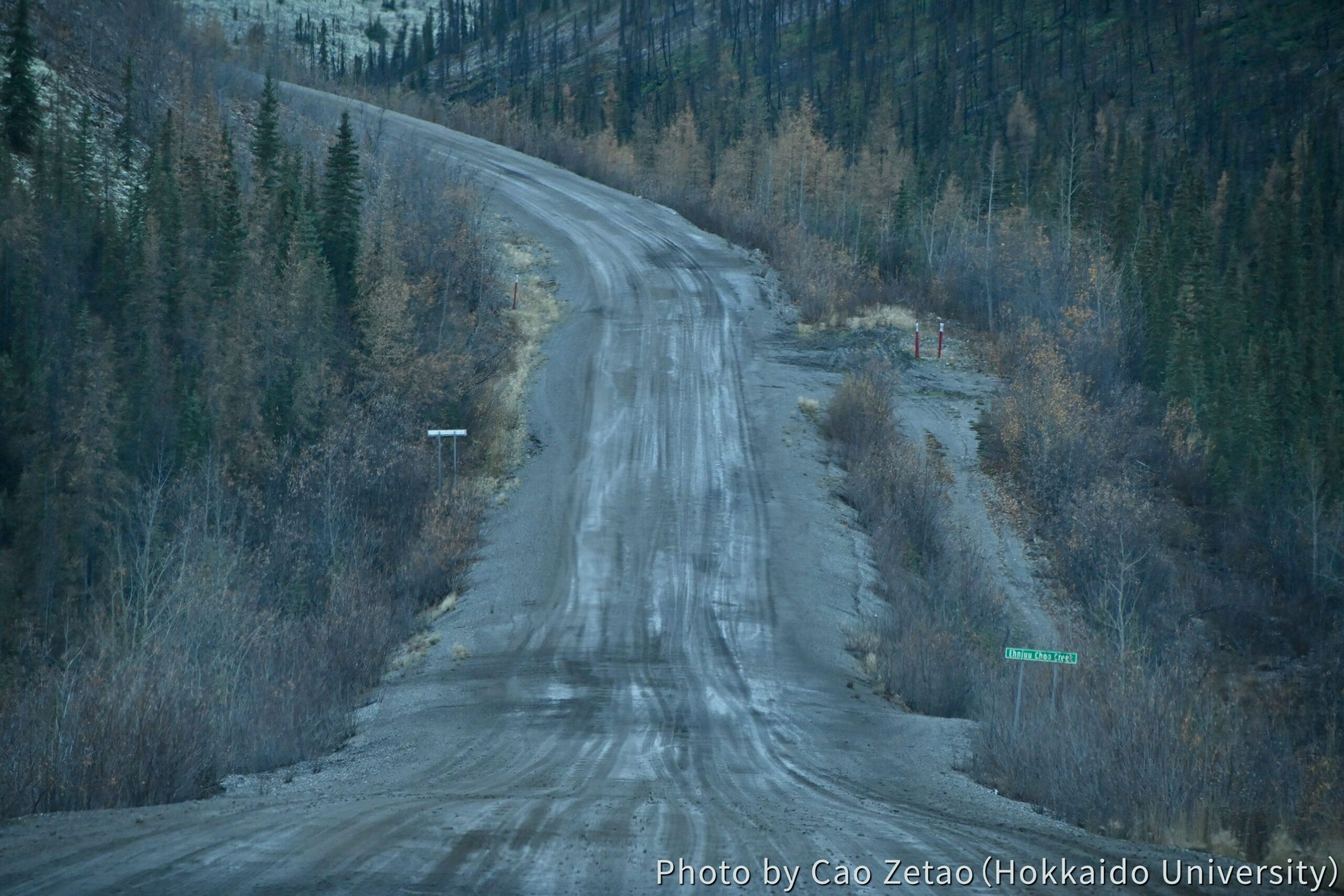
After three flights from Sapporo to Whitehorse, the Yukon Territories, Canada, and two days of driving along the Dempster Highway (Photo 1), we arrived at Eagle Plains, the only settlement with reliable accommodation in that area. From this base, we conducted daily excursions to both burned and unburned sites between approximately 30 and 70 km southwest of Eagle Plains.
Site selection followed our pre-analysis, which helped identify contrasting deformation behaviors, vegetation conditions, and topographic settings. The field sites represented a gradient of post-fire ages, from areas burned within the last decade to those affected more than thirty years ago, allowing us to capture various stages of permafrost evolution under comparable environmental conditions.
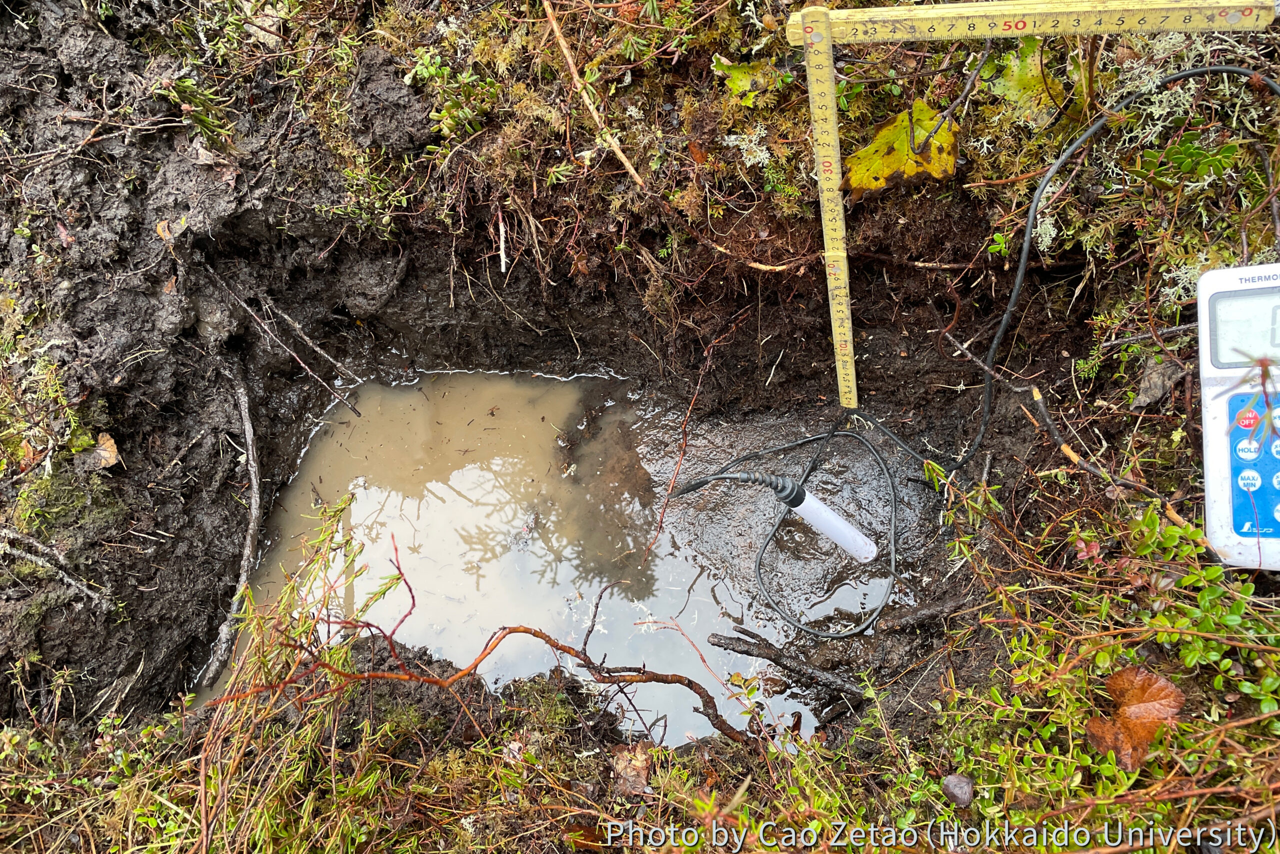
At each site, we carried out systematic permafrost and vegetation surveys. For permafrost characterization, we measured the active layer thickness using a metal probe. We dug a soil pit at each site and measured soil temperature at 5 cm intervals down to the frozen layer. In several locations, we could find ice lenses that were in the form of layered sheets of ice formed in the soil as water freezes and expands (Photo 2), and pore ices that fill the tiny spaces between soil grains when the ground freezes.
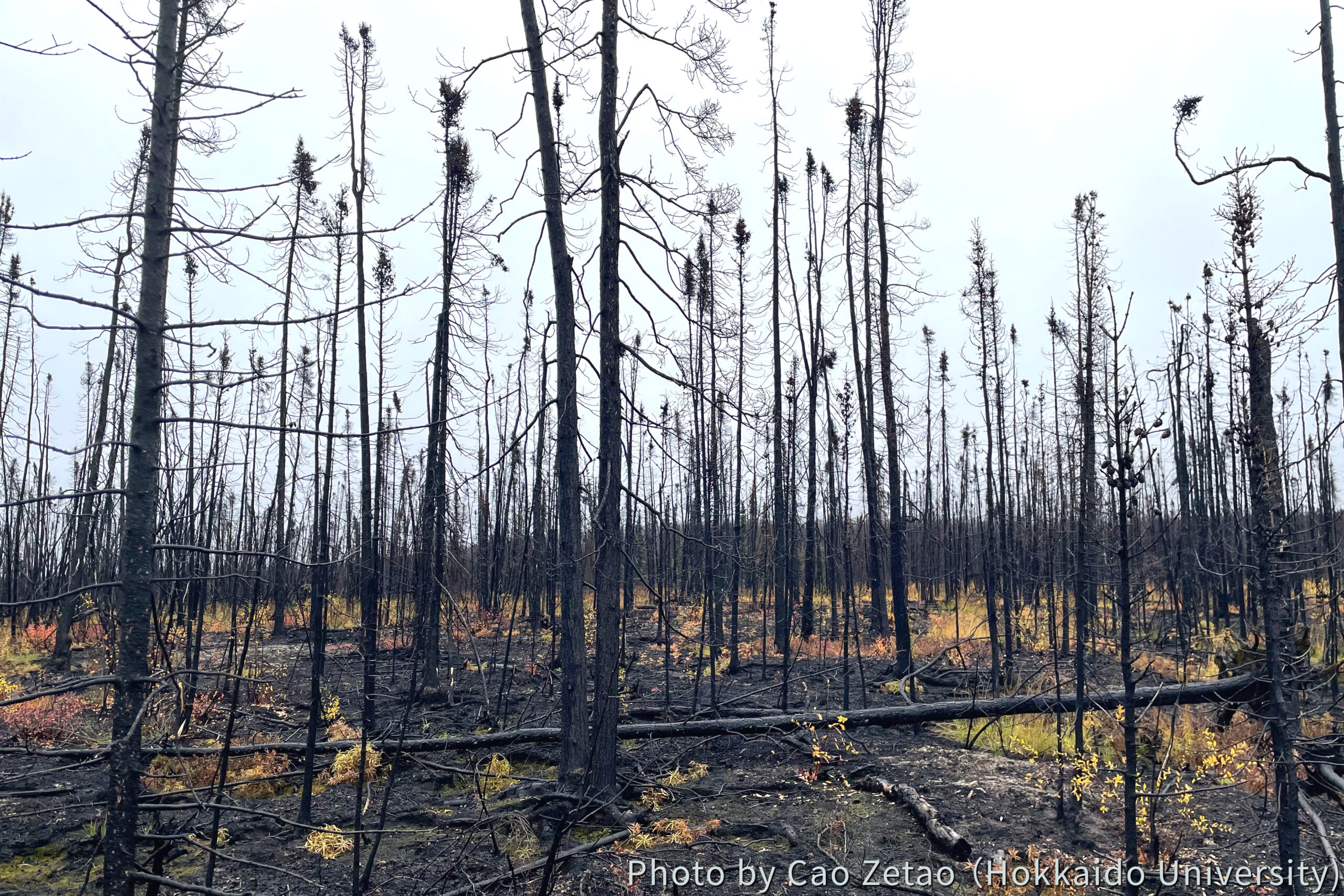
We also noticed the vegetation regeneration process across sites. The vegetation type revealed clear differences corresponding to post-fire age. Recently burned areas were dominated by early-successional tussocks (Photo 3), while older scars exhibited denser shrubs, accompanied by re-established black spruce stands.
The field data collected during this fieldwork will be integrated with our satellite observations to refine the interpretation of InSAR-derived ground deformation. The combination of field and remote sensing information will allow us to better describe the relationship between vegetation recovery, organic layer thickness, and permafrost dynamics under the disturbance of wildfires.
Overall, any future possible fieldwork in North Yukon was highly productive and provided invaluable insights into the long-term permafrost dynamics after wildfire. It not only validated the remote sensing results but also deepened our understanding of the interactions between vegetation succession, permafrost regimes, and ground deformation. The findings will contribute to our ongoing efforts to model disturbance-driven permafrost evolution and to improve predictions of circum-Arctic permafrost landscape responses under continued climate warming.