Release date
Observations on Sea Ice in the Arctic Ocean: Sampling, Measuring, and Photographing Ice Cores
Post date:
Author: Muraoka Shotaro
(2nd-year Master’s Student, Graduate School of Engineering, Kitami Institute of Technology)
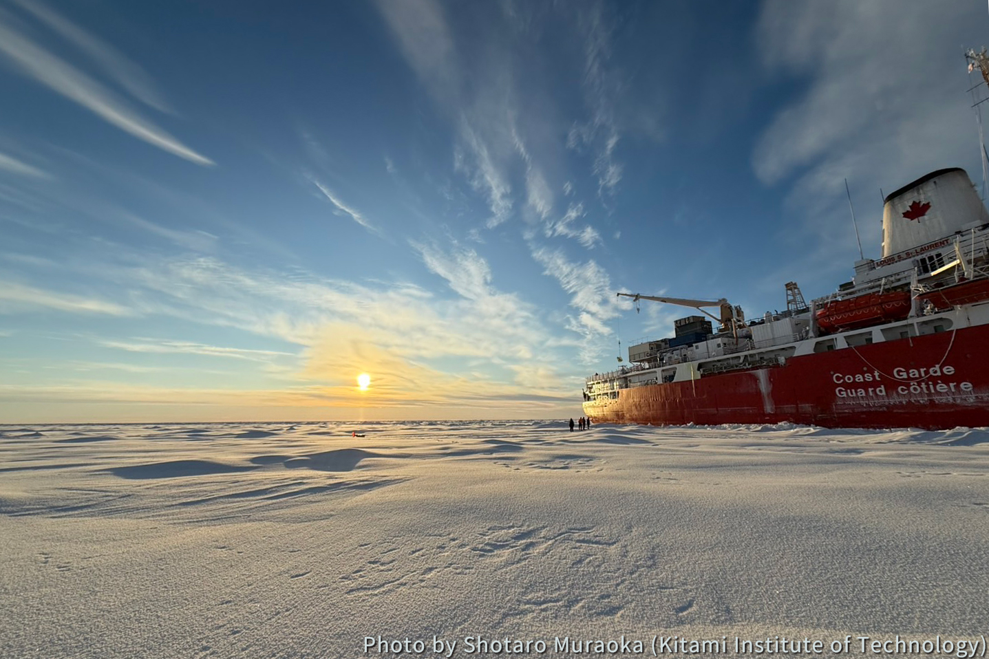
I participated in the international collaborative project “Joint Ocean Ice Study (JOIS) 2025”, which was conducted in the Arctic Ocean. During JOIS2025, observations were carried out from September 18 to October 23 aboard the Canadian Coast Guard icebreaker Louis S. St-Laurent. In this report, I would like to introduce the ice observations conducted during JOIS2025.
Before the actual measurements could begin, we faced many challenges just reaching the ice surface. Using satellite imagery and an ice radar, we searched for flat ice floes suitable for landing. As approaching an ice floe, the ship’s speed was reduced, and we carefully stopped to avoid breaking the ice. However, cracks often formed just as we approached the target floe, making it difficult to find a suitable location to disembark.
On one occasion, when we finally found a potential landing site, a polar bear and her cub appeared on the floe. While I was excited to see them, it was disappointing that we could not go onto the ice for safety reasons—a moment that was both thrilling and frustrating at the same time. Even so, we were fortunate to have two opportunities to go onto the ice during this cruise. (Photo 1)
During the ice observations, various measurements were conducted, including buoy deployment at the ice station, measurements of ice thickness and snow depth, and ice core sampling. Among these, I was in charge of ice core sampling, measurement, and photography.
The ice cores were collected using a 1 meter-long, 4-inch-diameter corer equipped with a newly developed electric-powered auger head. Immediately after collection, a small hole was drilled at the 5 cm mark from the top of the core using a manual drill, and temperature measurements were then taken at 10 cm intervals. After the temperature measurements, each core was cut into 5 cm sections to measure density, then sealed in bags, melted onboard, and analyzed for salinity using a portable salinometer.
This year, as a new initiative, we also used the LiDAR function of an iPad Pro to record the three-dimensional shape and volume of the ice cores, aiming to improve the accuracy of density estimation.
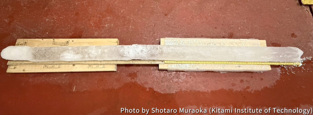
Photo 2: Collected Ice Cores (176.0 cm)
Participation in JOIS2025 was an extremely valuable experience for me. Through this project, I realized the many challenges involved in collecting data in the field and gained a renewed appreciation for the observation data that I use in my research every day. This experience has strengthened my motivation to further advance my own research.